Bentley Systems unveils application for civil site
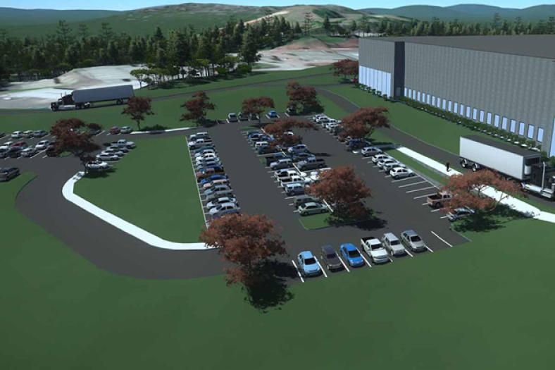


Bentley Systems announced the availability of OpenSite Designer, its integrated application for civil site and land development workflows across conceptual, preliminary and detailed design phases. OpenSite Designer advances BIM through comprehensive 3D site design, spanning reality modelling of site conditions from drone imagery and scans, geotechnical analysis, terrain modelling, site layout and grading optimisation, stormwater drainage modelling and analysis, underground utilities modelling, detailed drawing production and enlivened visualisations.
OpenSite Designer enables rapid and iterative conceptual design, leveraging contextual information obtained through point clouds, reality meshes, GIS and other sources to enhance understanding of existing site conditions. Interoperating with PLAXIS and SoilVision, Bentley’s geotechnical engineering solutions, site plans can be enhanced with new information about the active properties of soil including bearing capacity, stresses and displacement.
With OpenSite Designer, users can create intelligent 3D models containing site information, terrain data, parking lots, building pads, driveways, sidewalks, parcel layout and related site features. During preliminary design, the site engineer can complete and subjectively improve the layout while relying on further automated optimisations, which respond to the engineering changes. To complete the project’s digital workflows, OpenSite Designerfully supports the site engineer’s detailed design including the production of all required project deliverables.
Cookie Consent
We use cookies to personalize your experience. By continuing to visit this website you agree to our Terms & Conditions, Privacy Policy and Cookie Policy.